All Trail Alerts can be seen on the Interactive Map. Reroutes are reflected on the interactive map, but NOT on the pdf maps. For details about these Trail Alerts, see below. If you experience a significant obstacle along the BCT, please email us so that we can update the Trail Alerts accordingly.
Updated 6/8/2026
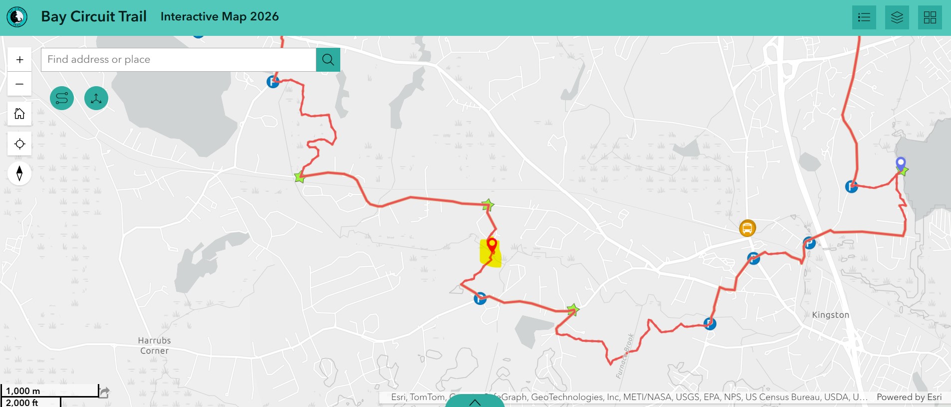
A small bridge crossing over the Jones River in Kingston has deteriorated to the point of failure. We are looking into solutions and will post a reroute in the coming weeks. Please bear with us as we resolve this. (6/8/26)
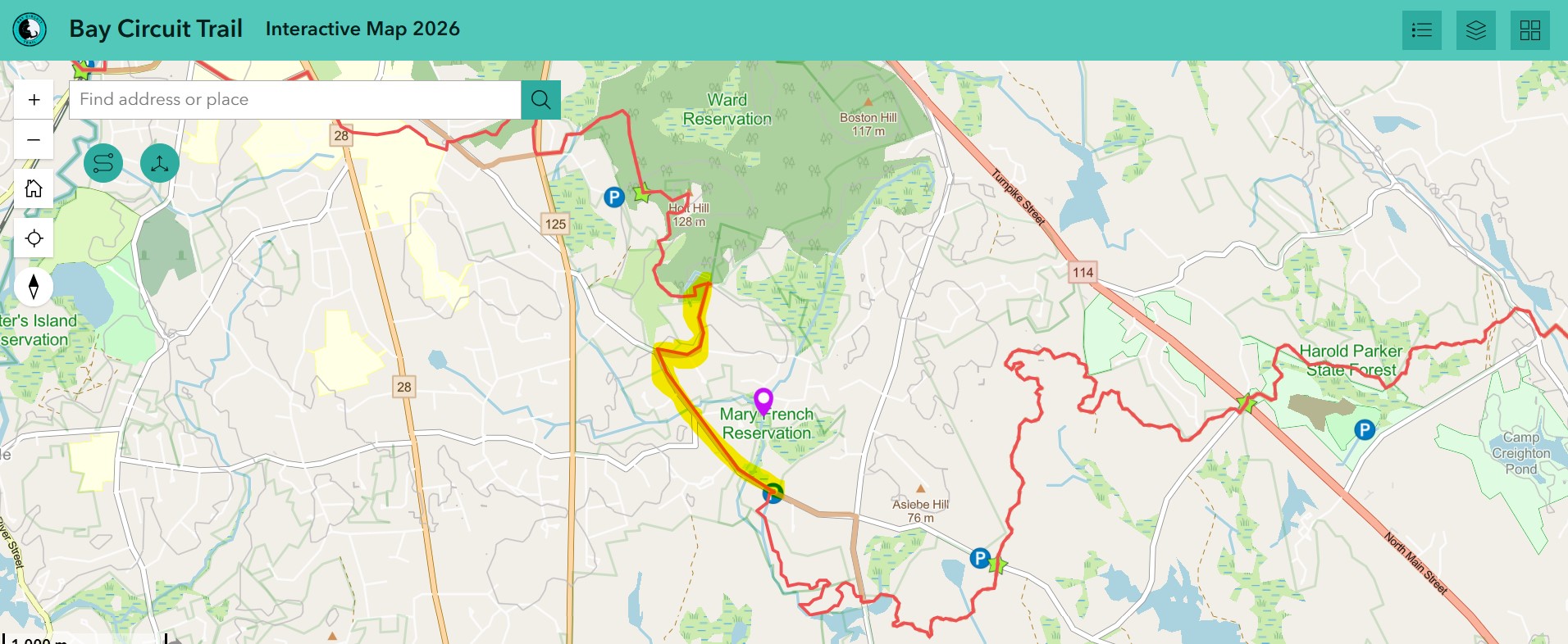
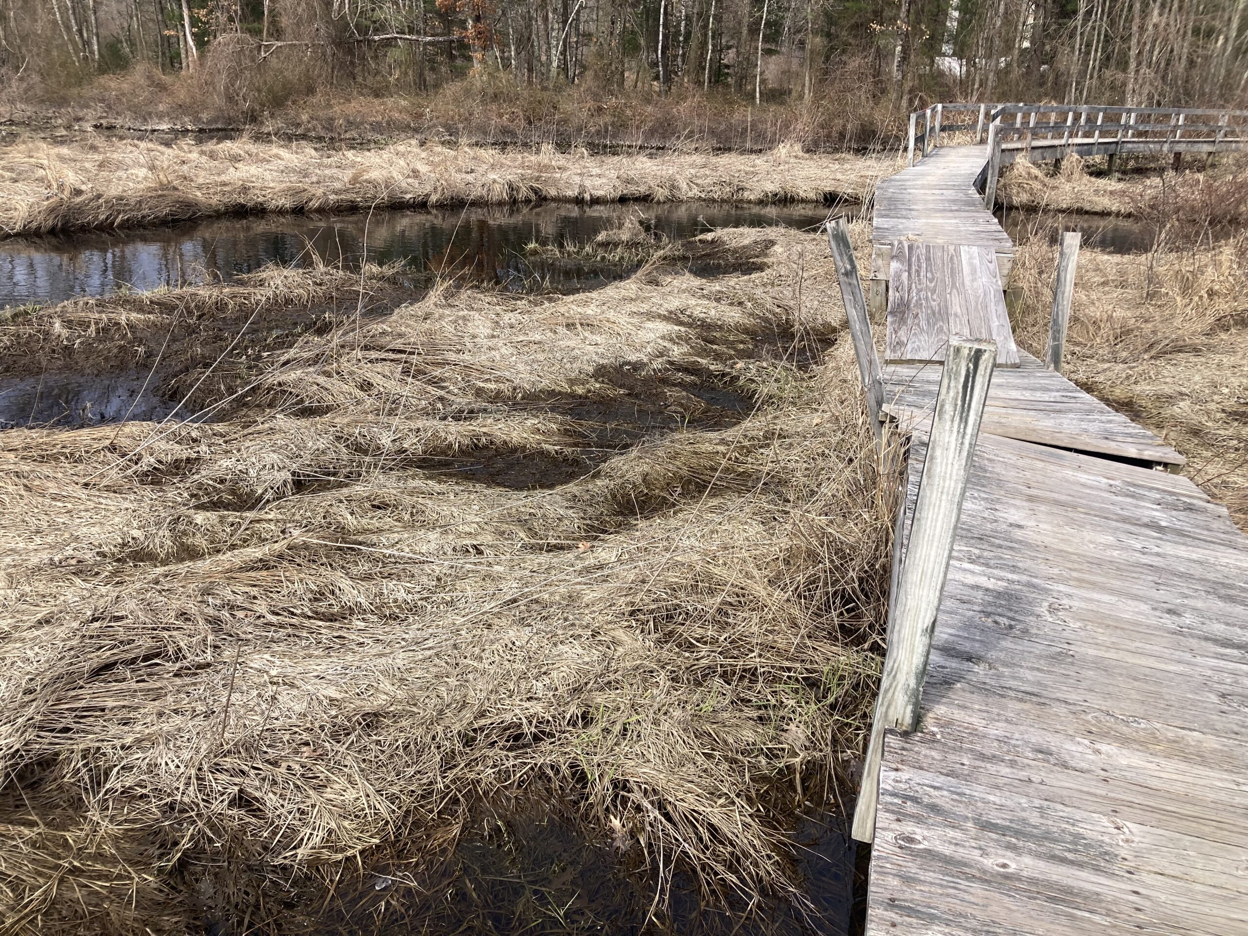
“Due to ongoing repairs to the Mary French Boardwalk, public access is restricted. Bay Circuit through-hikers (westbound) should proceed from the Skug Reservation left/northwest on Salem Street for 7/10 of a mile, enter the Ward Reservation on the right near the intersection with Gray Road, and rejoin the Bay Circuit Trail at the top of the hill. Eastbound hikers may pass through the Ward and Great Swamp reservations to Gray Road and the intersection with Korinthian Way. Follow Gray Road, 5/10 of a mile, to the intersection with Salem Street. Left on Salem Street for 7/10 of a mile and right into the Skug Reservation. ” – Andover Trails
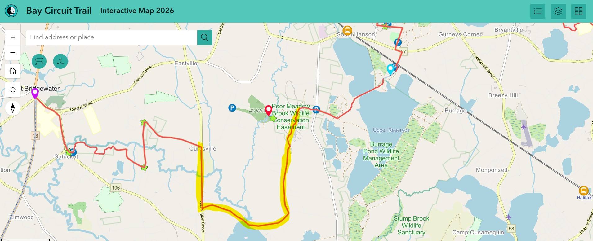
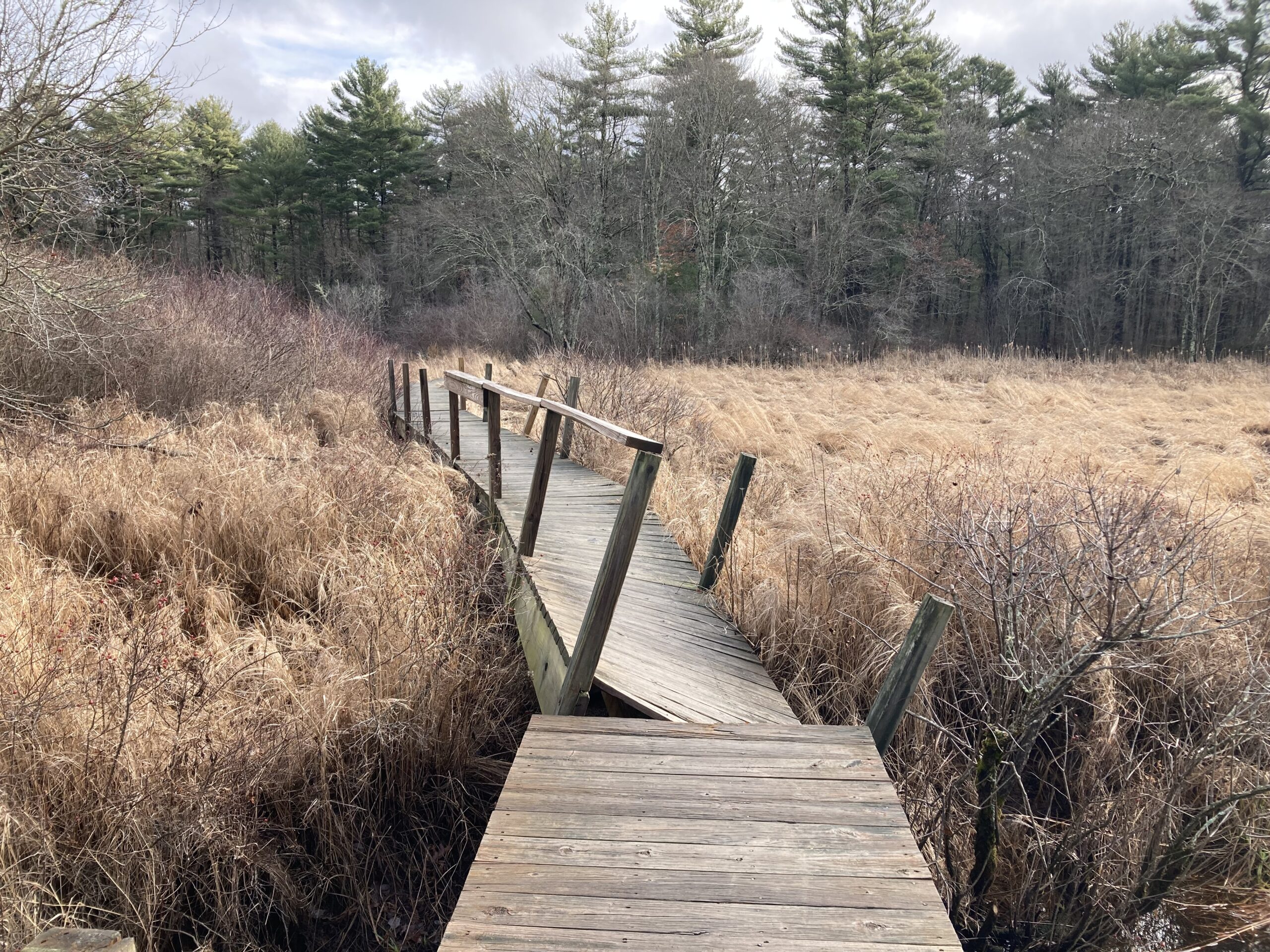
Poor Meadow Brook Boardwalk in East Bridgewater / Hanson is no longer safely passable due to deteriorating wood, broken structural supports, and high water levels. Please take the temporary reroute shown on the Interactive Map. Heading east from East Bridgewater on Crescent St, turn right onto Washington St until you reach Pond St. Follow Pond St and then turn left onto Hudson st. Look for a left turn onto a wooded trail between two homes on Hudson St. The temporary BCT is marked with new blazes and will direct you out to the old BCT along the powerlines in Hanson.
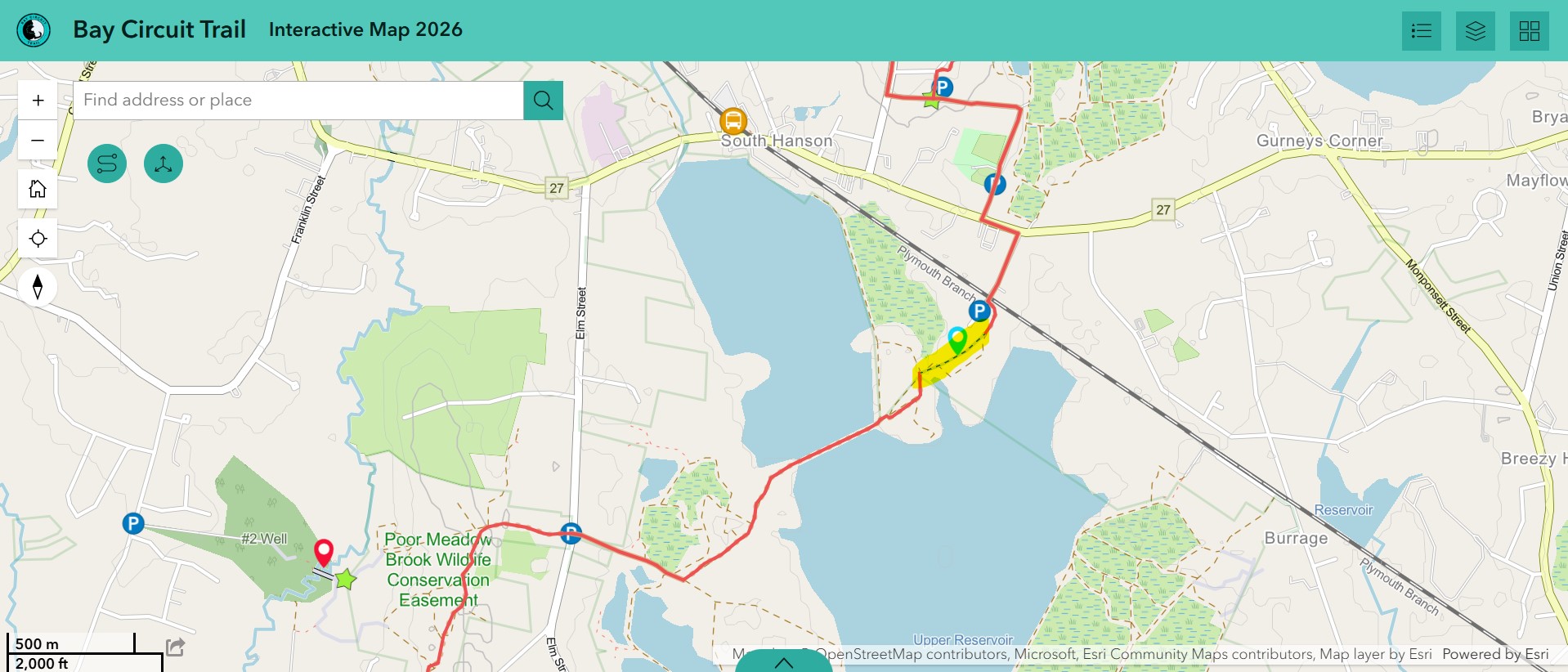
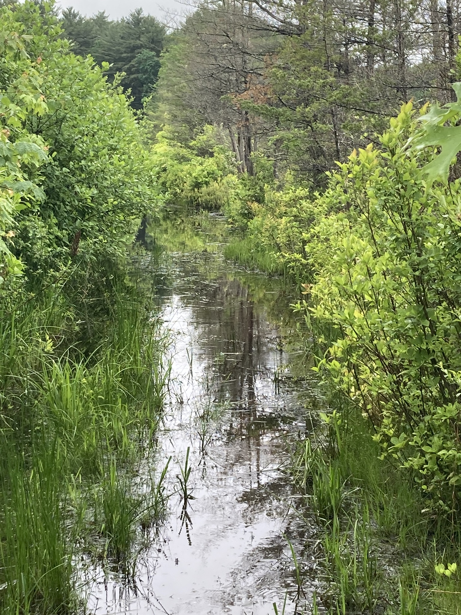
Burrage Pond Wildlife Management Area is a beautiful property to check out along the BCT. The crossing of the swamp was once a raised dike that has been deteriorating and is no longer above the water level of the swamp. This crossing is the most direct route across Burrage but it is often underwater. It is about 0.5 miles long. Sometimes the flooding is only an inch or two deep and other times it has been up to 3 feet deep. As of 5/4/26 the water is 2-3ft deep. This depends on the season and amount of rainfall, but it is rarely dry. You may traverse this at your own risk. The alterative is to road walk a few miles around the entirety of Burrage Pond along Rt 27 and Elm St in Hanson or to plan your trips in a way that does not require you to cross the swamp. We are investigating solutions to this obstacle. Bikes be warned, cycling across this section is near impossible during heavy flooding.
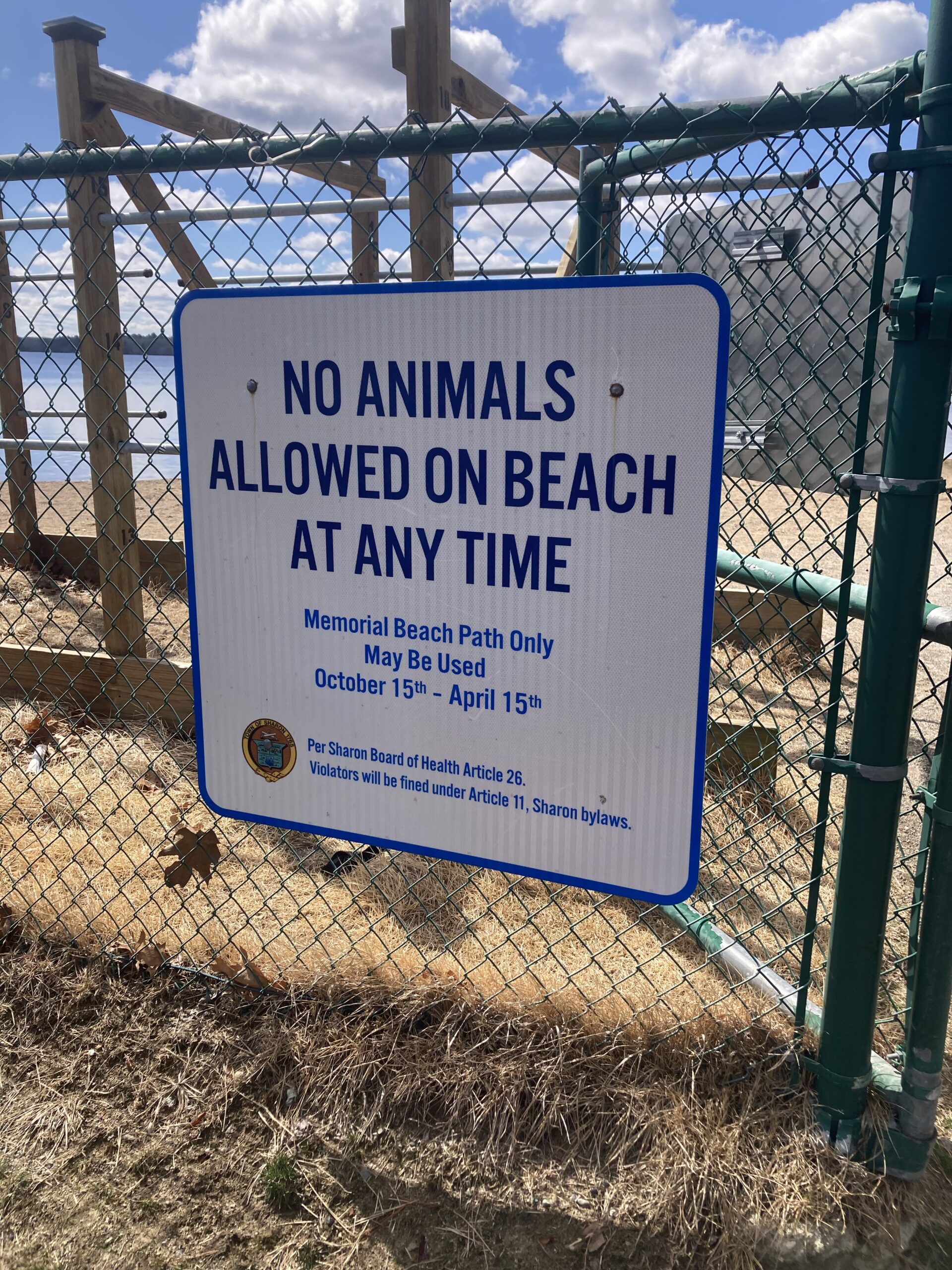
Memorial Beach Path in Sharon is only available to BCT hikers during the off season annually between Oct 15th and April 15th. During the spring/summer between April 16th and Oct 14th you must take a detour around the Memorial Beach Path. Please use the sidewalks along Beach St and Pond St to bypass the park. Police presence at Memorial Beach Park WILL NOT not allow hikers through. Please use the detour. Signage is being made to notify BCT hikers of this.
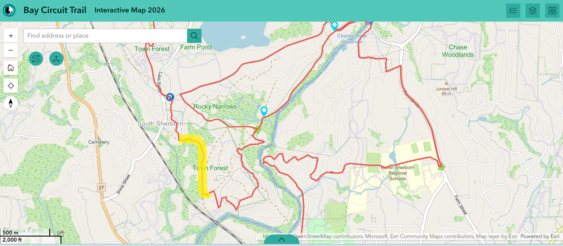
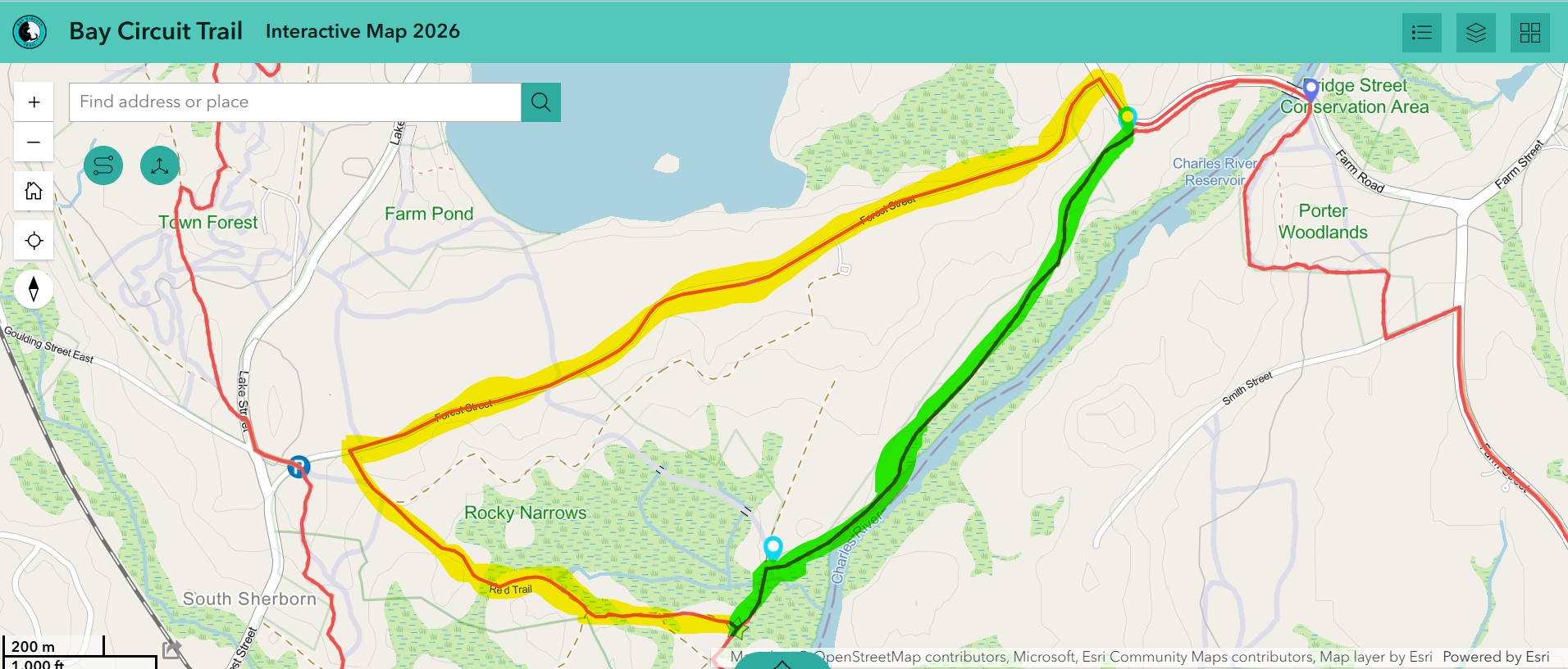
Two designated routes are available in and around Rocky Narrows in Dover and Sherborn. The trail that follows the Charles River is often flooded. When planning your hike, please see this link to get the daily Charles River “gauge height.” If the height is above 3 feet, please plan to avoid the Recommended River Walk route and instead use the Alternative route.
Recommended River Walk Route: Continue straight across the wetlands on the causeway. Turn right to follow the River Trail paralleling the Charles River for a little less than a mile up to Sherborn’s Farm Road shoulder parking.
Alternative Forest St/Farm Road Route: Turn left andd follow Red Trail and proceed up the trail that eventually intersects with Forest Street, just east of the Rocky Narrows Forest Street parking lot. Turn right on Forest St. and proceed about a mile to just shy of Sherborn’s Farm Road, where you’ll turn right into the meadow. Go left for a few steps to arrive at the Farm Road shoulder parking. Alt route is approx. 1.6 miles.
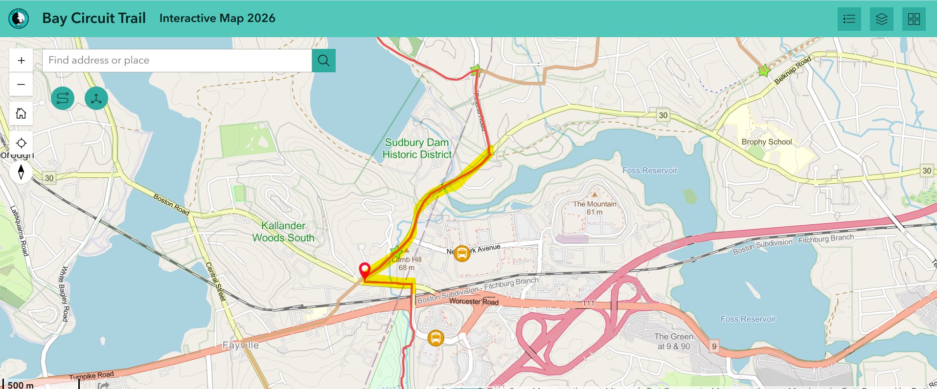
The BCT directs you along Route 30 in Southborough and Framingham but this is one of the most dangerous road walks of the trail. This stretch of road includes blind curves, high traffic, and little to no road shoulder. Route 30 connects to Firmin Ave at a 4-way intersection with no sidewalks or crosswalks. The walk up Firmin Ave to the bridge that crosses Route 9 is also extremely dangerous. Please wear high Vis clothing and, if you can, walk this stretch at a low-traffic time. Currently, we are collaborating with Southborough Trails to create a small reroute around the bridge on Rt 30 to reduce road walk.
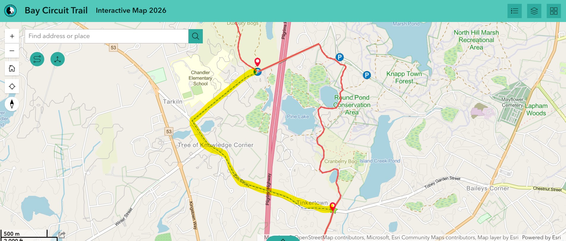
East St in Duxbury has been closed for the better part of a year and was scheduled to reopen in June of 2026, however, as of June 8th 2026 East St is still closed. Until it has been reopened, a detour around East St follows East St south from Duxbury Bogs (right when departing the parking lot) to Summer Street. Turn left onto Summer St and follow it until it becomes Elm St. From Elm St continue until you reach the junction with School St. Head south onto School St (right) and continue to Kingston Bay. Warning that these are trafficked roads with no sidewalks. Elm Street is very wide and can reasonably be walked, but please wear reflective gear for safety and visibility.
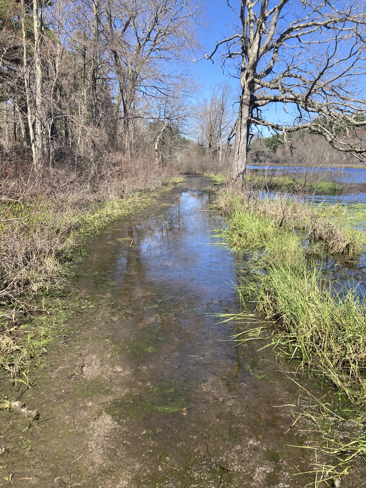
Extensive flooding is occurring along the Red Trail in Rocky Narrows. This section of flooded trail is marked below. As of 4/26 the flooding was about calf deep for a few hundred non-consecutive feet of trail that follows the edge of an expansive wetland.