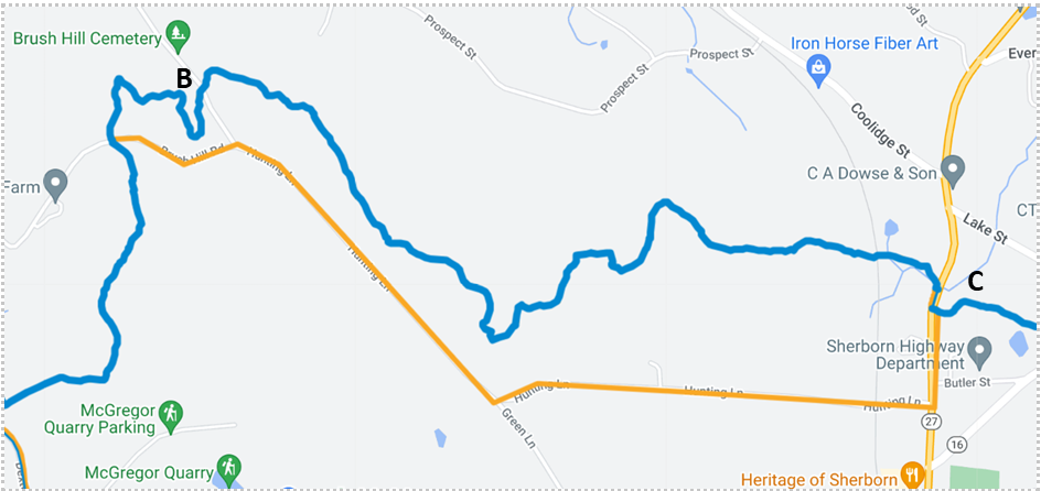
A logging operation in Sherborn Town Forest will begin on Feb 5th, 2024. As a result, the BCT will be closed from Point B (Perry St) to Point C (Route 27 crossing) on Map 9 until further notice. A temporary reroute has been updated on the Interactive Map. This reroute is open to hikers and bikers. The reroute is primarily on back roads with no shoulder or sidewalk: please use caution. An update will be posted when the logging operation is complete and the original dedicated route is safe to use again.
Written Directions Heading Southbound:
At the road crossing of Brush Hill Rd, 0.4 miles before Point B on Map 9 turn right (east) and follow Brush Hill Rd onto Hunting Ln until it meets Route 27. At Roue 27, turn left (north) and follow the sidewalk until you reach the Recreational Trail Crossing sign on the east side of the road. Cross Route 27 and re-enter the dedicated BCT route at Point C on Map 9. The length of the temporary route is approximately 1.9 miles.